Google Earth: Now with 3-D trees, Street View integration

Google released a new version of Google Earth today - version 6 - and the big headline is the seamless integration with Google Maps and Street View. The street level zoom-in view previously had been limited but now can go deeper into the detail by using Street View. As users zoom, the new release automatically switches from Earth view to Street View to continue the journey.
It's a fun upgrade and one I'll admit that I lost some time this morning floating around the globe, zooming in and out of here and there for a closer look. After all, that's what Google Earth is all about, right? Exploration. Plus, it had been a while since I'd used it.
There were two other items worth noting - historical imagery and 3D trees.
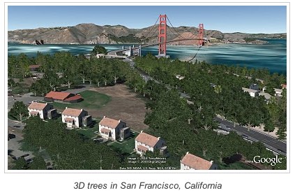
The 3D trees - which are exactly what you would expect - are supposed to add some realism to the exploration experience when you get down to the ground view. It did just that.
The historical imagery had been in Google Earth previously but apparently was hard to find. Now, when you zoom into a place, an alert at the bottom of the screen gives you a date for the oldest available imagery. Google suggested the Palace of Fine Arts in San Francisco to check out. The photos date back to 1946.
I really liked this feature and hope that more of the old aerial photos - and eventually historical maps, too - can be integrated into modern mapping technologies.
It was a fun little trip around the world this morning - but now it's time to get back to work.