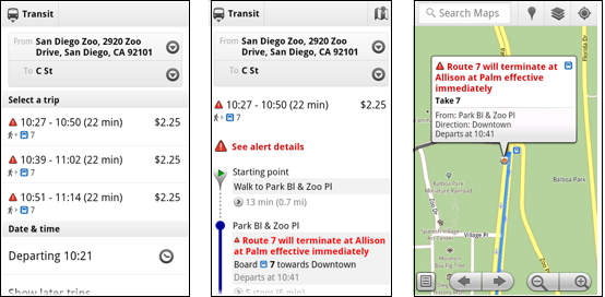
Google Maps to deliver live transit updates

Here's a Google project that everyone can support. Google Maps is being upgraded with new live transit updates so you know just how late that bus is going to be.
Available information will include both live and scheduled departure times, route maps and service alerts.
Transit riders will be able to view up-to-the-minute updates either via Google Maps on in a browser or on a mobile device as long as it is running Android 1.6 or higher. That shouldn't be too hard to come by for Android users these days.
At this time, this feature is only available in four U.S. cities. That would consist of San Francisco and Portland (which are predictable since these are two of the testing grounds for Google Offers) as well as Boston and San Diego, the last of which is a bit of a surprise to see rather than larger cities with busier transit systems such as Washington, D.C., Chicago and New York City. But given that these are the early stages of the project, it's probably better to master the system on a smaller city scale first.
Google Maps transit updates are also going live abroad in Madrid and Turin.
For a closer look at the new service, check out the promo video below:
Related coverage on ZDNet:
