Pentax Optio WG-2 GPS and digiKam - Part 2

I apologize for not including the digiKam information in the first part of this blog post. I have to admit that I underestimated how much I would want to say about digiKam, and overestimated the amount of time that I had to write it. So, here is Part 2, focused on using digiKam with photos taken using a GPS-enabled camera. For purposes of this discussion I have been using digikam 2.5.0 on openSuSE 12.1 and digiKam 2.6.0-rc on Fedora 17.
When youselect a pictjure that contains GPS information you can click the Geolocation icon on the right side of the digiKam screen, to add a small panel with an overview of the location:
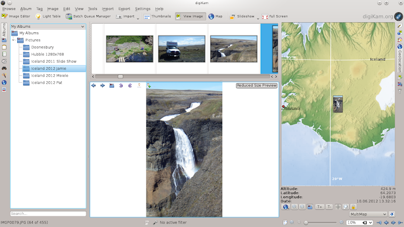
This is the "Image View" display, which shows a reduced-size image of selected picture, along with the Geolocation panel which shows the global location for the GPS data. The Geolocation display can be zoomed in and out as you wish, of course.
If you select more than one picture, the Geolocation window will show the location of each:
Here I have selected two images taken in different places, Of course you can select as many images as you want; when multiple images are located so close together that they can not be displayed separately, a single image will be displayed with a number on top of it indicating how many images are at that location. Zooming the Geolocation display on that location can sometimes expand the display enough to allow the individual images to be displayed. Zooming the Geolocation display on that location can sometimes expand the display enough to allow the individual images to be displayed.
If you are only interested in the Geolocation display, you can select Map from the display options at the top of the digiKam screen, and the image display will be replaced by a larger map display.
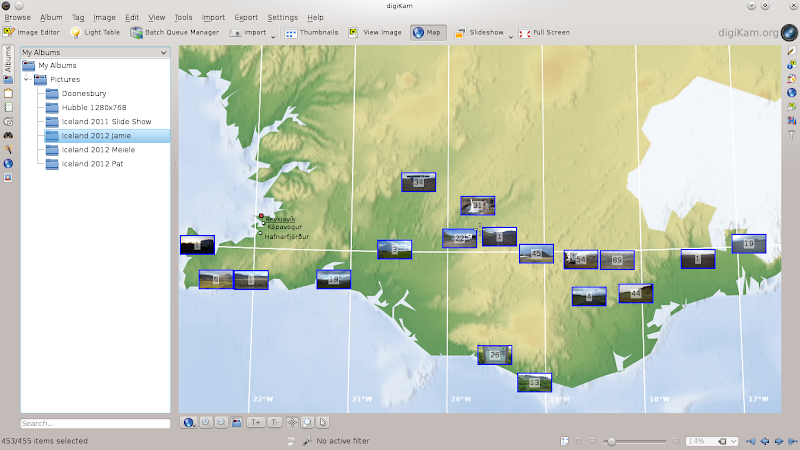
This can be particularly useful to get an overview of the distribution of the photos (or the area of travel where they were taken).
digiKam can also integrate with some of the online mapping sites to display Geolocation information. In the screens above, at the bottom right of the digiKam window there is a drop-down list of map sites, such as MultiMap, Google Maps and MapQuest. When you click on the globe symbol next to that list, a browser will be started and the Geolocation data will be sent to the selected map site. The default is MultiMap, which comes up with this:
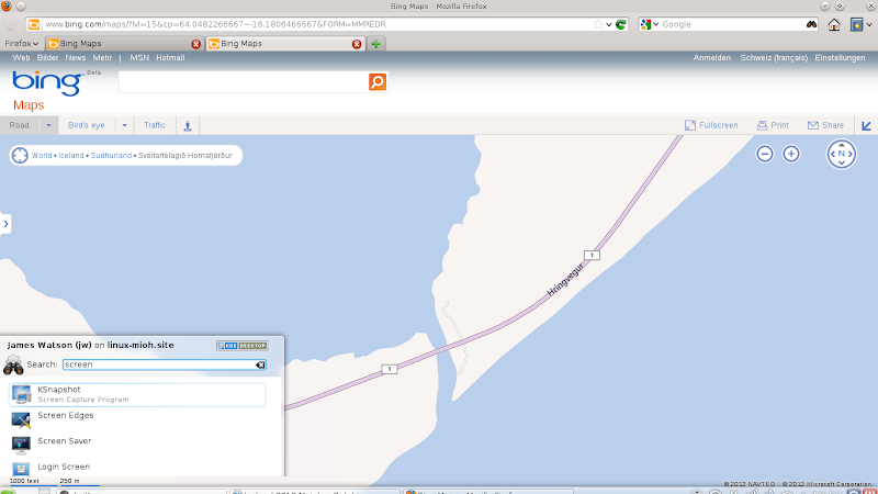
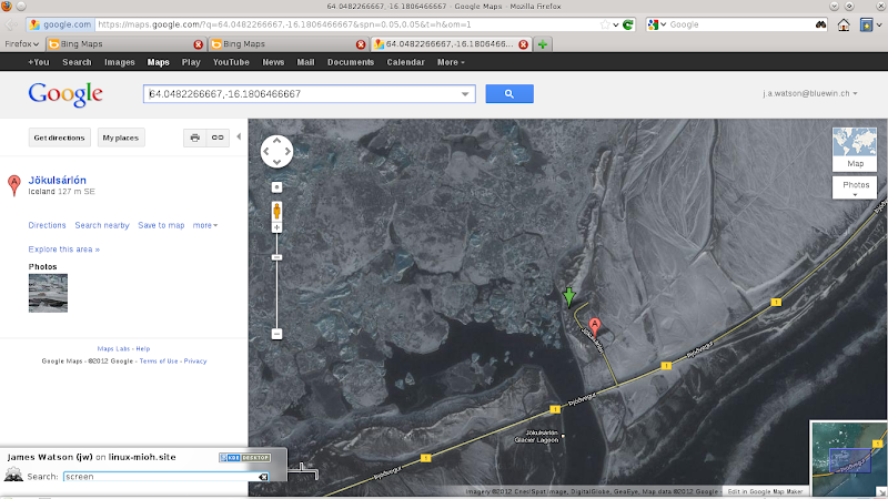
I generally use Google Maps, so when that is selected digiKam brings up this:
As far as I can tell so far, you can not select multiple pictures and then send them all to one of the online map sites for display, which is a bit unfortunate.
The combination of the Pentax WG-2 GPS camera and digiKam on Linux has given me some powerful new possibilities for working with my pictures. I'm quite pleased.
jw