Business
Google Maps gets real time traffic information
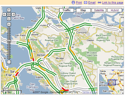
A brand new feature on Google Maps lets you see a visual representations of traffic in some major US cities. Green is ideal traffic conditions, yellow means there may be some delays, and red means you should probably expect stop and go traffic.

A brand new feature on Google Maps lets you see a visual representations of traffic in some major US cities. Green is ideal traffic conditions, yellow means there may be some delays, and red means you should probably expect stop and go traffic.
Imagine this feature available in a GPS navigation unit with wifi or 3G connectivity in your vehicle -- that would be cool.