To Boldly Go Where No Search Engine Has Gone Before

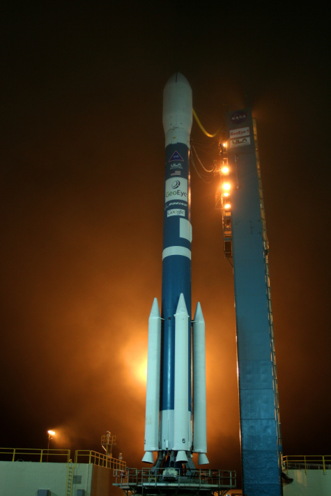
Google's new Imaging Satellite aboard a Boeing Delta II Rocket. Source: GeoEye
I don't know what it is about rockets, but I don't know a single man, hetero or gay, who isn't extremely turned on or even intimidated by them. I've never seen a space launch in person, but Google founders Sergey Brin and Larry Page are now members of a very exclusive clubthat have seen one up close and personal.
This weekend, Google launched its own imaging satellite, on top of a Boeing Defense Systems Delta II booster rocket, in partnership with GeoEye, the space imagery company which already provides data to Google for Google Earth and Google Maps using its existing IKONOSand ORBVIEW satellites.
Click on the "Read the rest of this entry" link below for more.
Why does Google need its own satellite? Well as my wife Rachel said to me this morning "To turn into that evil computer network thing in the Terminator movies." Okay, maybe not, but still, I thought it was funny.
Google needs its own satellite for a number of reasons. Right now, it gets its mapping imagery from a number of sources, including aerial photos and the IKONOS satellite, which is capable of 1 or 4 meter resolution. The new Google GeoEye-1 satellite will be able to snap continuous images of the earth at 1 or half meter resolution in full color.
While not nearly as sophisticated as what the US government reportedly has on the KH-12 and KH-13 which can read the registration numbers off a license plate from earth orbit -- in the .10 meter range or less, this is still a significant step forward in bringing advanced space imaging technology to the masses.
And because Google is going to be able to have near-exclusive use of this satellite for online mapping data, the photos will not get out of date like many of the current Google Earth images which are years old -- they'll be constantly refreshed, and Google and non-military US Government agencies will also be able to snap images within hours of significant geographical events occurring, such as major floods and damage from hurricanes.
And yes, half meter resolution is definitely good enough to pick out things like troop movements amassing on borders or pick out the kind of tactical details that used to require reconnaissance aircraft 30 or 40 years ago.
Is Google becoming SkyNET with its new GeoEye-1 satellite or a beneficial service to netizens everywhere? Talk Back and let me know.