Mapping where Google left off

Google did a pretty good job of giving us snapshots of streets around the world, but it never took its mapping project to the bottom of the ocean. The folks at the University of Sydney are now filling in that hole, so to speak.
It might not look like much in the photo, but the Autonomous Underwater Vehicle can tell us a lot about what's going on around the seabed. It will take 50,000 high-definition "i3D" images per day, and collect other data as it goes. Associate professor Stefan Williams, who leads the robotics team at the University of Sydney, says that it can cover an area of several kilometres in a single day.
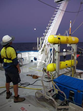
(Credit: University of Sydney)
The device is called Sirius. We know what you're thinking: surely they can't be Sirius? But they are. In fact, they've done it all before, back in 2007. Now they're setting out to do it again, in the same spot at Ningaloo Reef, a short swim from the coast of Western Australia near Exmouth. They'll be able to compare data, and see what's changed down below.
Professor Williams says it is being used in other areas around the Australian coastline, but having the ability to compare change over five years makes the Ningaloo Reef project unique. The researchers hope that they'll be able to predict future changes in the underwater environment from their observations.
There's no word yet on whether we'll all be able to see the underwater images mapped out for us online, so for now, at least, dugongs and whale sharks (unlike humans) are offered a little privacy protection.