Polar meltdown both north and south


“This continued and often significant glacier retreat is a wakeup call that change is happening in our Earth System and we need to be prepared,” said USGS glaciologist Jane G. Ferrigno, lead author on the study. “Antarctica is of special interest because it holds an estimated 91 percent of the Earth’s glacier volume, and change anywhere in the ice sheet poses significant hazards to society.”
Here's the USGS press release on their latest Antarctic meltdown report.
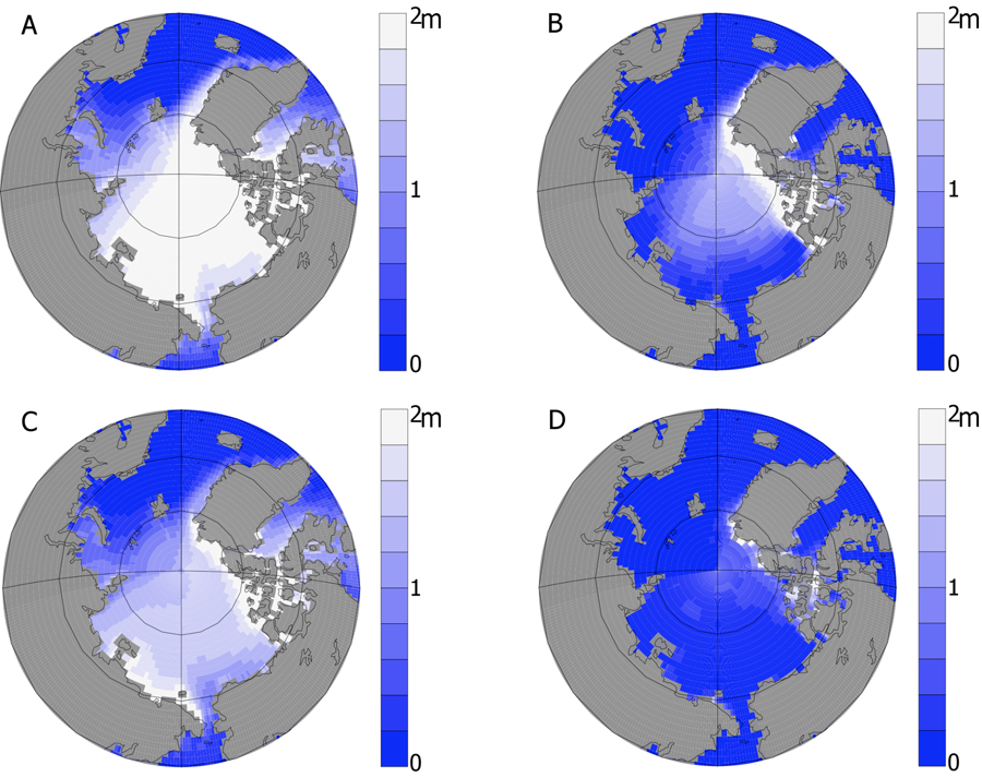
Meanwhile, NOAA has published new data on Arctic ice sheets, showing meltdown there is accelerating. They conclude the Arctic may enjoy ice free summers in thirty years, not the end of this century as was earlier projected. Not enjoying those Arctic ice free summers will be coastal towns across the earth, polar bears and the Panama Canal which stands to lose all its shipping traffic to the Northwest Passage.
The area covered by Arctic summer sea ice is expected to decline from its current 4.6 million square kilometers (about 1.8 million square miles) to about 1 million square kilometers (about 390,000 square miles) – a loss approximately two-fifths the size of the continental U.S. That'll happen as quickly as three decades. Much of the sea ice would remain in the area north of Canada and Greenland and decrease between Alaska and Russia in the Pacific Arctic.
“The Arctic is often called the ‘Earth’s refrigerator’ because the sea ice helps cool the planet by reflecting the sun’s radiation back into space,” said one NOAA scientist. “With less ice, the sun’s warmth is instead absorbed by the open water, contributing to warmer temperatures in the water and the air.”
Only a portion of the Arctic glaciers are over land so they're melting will have less effect on sea levels than melting above Antarctic's land mass. [poll id="111"]