Google Maps goes underwater: In pictures

Google Maps has shown off its latest enhancement — a series of underwater panoramas in select places around the globe.
Announced on Tuesday, the underwater vistas comprise six sites of marine interest: Wilson Island, Heron Island and Lady Elliot Island in Australia's Great Barrier Reef; Hawaii's Hanauma Bay and Molokini crater; and the volcanic reserve of Apo Island in the Philippines.
"With these vibrant and stunning photos you don't have to be a scuba diver — or even know how to swim — to explore and experience six of the ocean's most incredible living coral reefs," Brian McClendon, VP of Google Maps and Earth, said in a blog post.
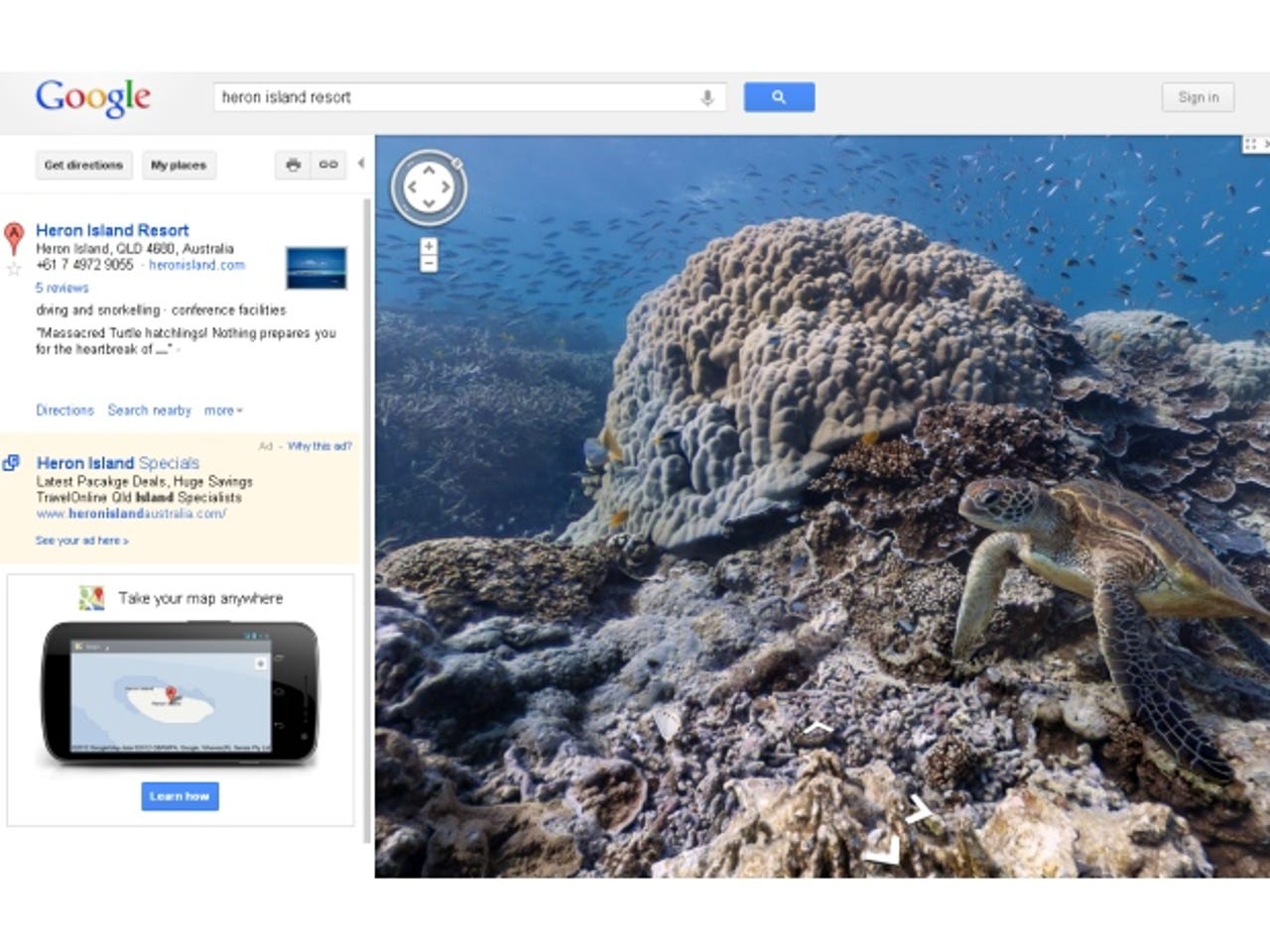
Above, a turtle is captured off Heron Island in Australia.
Google teamed up with the Catlin Seaview Survey, which is sponsored by the UK-based insurer Catlin Group, to produce the new images.
The Survey used its custom-built SVII camera to photograph the 360° panoramas, which capture turtles, fish and manta rays in their natural environment. The camera, one of only two in the world, takes pictures every three seconds while travelling at around 4kph. The resulting images are stitched together digitally. The underwater panoramas will eventually comprise 50,000 images, according to the Survey.
Users can zoom in on the ocean views, although you can't yet 'walk' around, unlike in Google Street View.
Above, divers bob in the sea above Molokini Crater in Hawaii, a partially submerged volcanic crater and popular diving spot.
Above, the camera bobs just below of the surface of the sea at Wilson Island in Australia.
Data gathered from the dives will go into a public database called the Global Reef Record, according to the Catlin Seaview Survey. "The Global Reef Record is a game-changing scientific tool that scientists around the world will have at their fingertips. They will be able to monitor change in marine environments now and in the future," Professor Ove Hoegh-Guldberg, the project's lead scientist, said in a statement.
Above: the knobbly seabed landscape of Apo Island in the Philippines, home to more than 400 species of coral.
Google's Brian McClendon described the underwater panoramas as "the next step in our quest to provide people with the most comprehensive, accurate and usable map of the world"; possibly a veiled dig at rival Apple, which has taken flak for errors and odd imagery in its new mapping service for iOS 6.
Google has certainly been driving its Street View technology into new areas in the last few years. In 2011, Google Art Project photographed the interiors of some of the world's biggest art galleries, allowing people a close-up look at famous paintings from their armchairs. It has also announced plans to use its Street View tech to snap the interiors of shops and restaurants.
The ocean images are unlikely to run into the same sort of complaints over invasion of privacy that met the original Street View service, unless scantily clad snorkellers and aggrieved fish take exception.