Where 2.0 gives direction to new world of mapping

Conference co-chair Nathan Torkington got things rolling with a look at the forces that have led to where we are today, in particular, Goggle first opening up its mapping application to hackers and then adding satellite imagery. As recent as yesterday, Google released Google Maps APIs and Google Earth. In turn, Microsoft responded with MSN Virtual Earth, and Yahoo plans to release its own Maps API tomorrow. These moves are leaving traditional GIS players like ESRI and MapQuest in the dust. "Old operators are getting nervous with the value of displaying maps going away," said Torkington.
One issue Torkington brought up was how can Google continue to offer its service for free when the data costs money to license. He responded by saying that local search is the answer. "In 6 months we will see syndicated local search that will let hacking make money…Content plus location equals gold for advertisers."
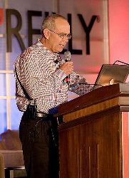
After Torkington’s introduction, David Rumsey, a prominent historical map collector, author, and geospatial visionary, wowed the audience with his survey of the evolution of maps. "Something interesting is happening. The idea of place not just a specialty corner but central to what we do…Our ability to map location grows as computational power grows," he said. His presentation visuals traced the progress of mapping from the start centuries ago to present day. He then showed overlays of historical maps onto 3D generated video maps which you can "fly" through. "Maps are exciting when they are more fluid, remixed…Maps influence each other, grow out of each…The better they visualize the world and the more accurate they are, the more they are used," he stressed. In the future, according to Rumsey, there will be no unknown spaces, and the challenge will be to create more info about them.
The remaining mini-keynotes consisted of; John Frank, Founder and CTO of MetaCarta, who talked about his geographic search application for enterprises; Udi Manber, CEO of A9, who showed how they drove around the country taking digital pictures of storefronts that now bolster Amazon's Yellow Pages (click here for image and location of conference hotel); Michael Frumin from Eyebeam, a media arts non-profit that caused a stir with its Fundrace projects during the last presidential campaign; and Stephen Lawler from Microsoft, who demoed MSN Virtual Earth, detailing features like map labels, integrated local search features, and most interesting, a scratch pad that can be used to build itineraries which then can be saved, emailed, and even blogged.
(David Rumsey photo courtesy of Duncan Davidson/O'Reilly Media)