How Autodesk's 3D design tools help create sustainable cities

Before ground breaks on any sustainable infrastructure projects they first have to be imagined and designed. The design process is now more quick and efficient, thanks to software like Autodesk's 3D design software. But how much impact can 3D design software have on sustainable cities and infrastructure?
I talked with Terry Bennett, Senior Industry Program Manager for Civil Engineering and Planning at Autodesk, an influential $2 billion design software corporation, to find out.
Bennett -- who is also a council member on the Urban Land Institute’s Public Development & Infrastructure Council -- discussed how Autodesk's 3D modeling software makes it easier to create sustainable cities and infrastructure, by allowing designers to dream big while creating designs quickly, efficiently, and with more information about the design than ever before.
Read the interview below:
Smartplanet: Explain the significance of planning and design technology for sustainable cities?
Terry Bennett: The way we have to deal with infrastructure going forward is, there's going to be no easy answers, so you have to be able to simulate multiple things at the same time, do multiple analysis, whether it's cost, to carbon footprinting, to water footprinting, economic footprinting, whatever it may be. You want to put all those as parameters as part of the design. It's that tweaking that minimizes all the environmental impact as well.
That's where [Autodesk], over the last number of years, put a real emphasis in Building Information Modeling, BIM. Because BIM really is a integrated collaborative 3D modeling technology that allows everyone involved in the project to work from a model that they can share reliable information. It looks at it from planning through designing through construction.
Autodesk allows our customers to analyze existing infrastructure conditions, model some alternative sustainable solutions that they think would solve the problem, but more so be able to visualize and simulate the performance of that soon-to-be infrastructure.
The end result is that cross-disciplinary collaboration will help to reduce design errors, it avoids mistakes and conflicts in the field, increases productivity, and more importantly reduces the risk and liability of putting these big projects up in these confined urban environments.
SP: What tools has Autodesk developed specifically with sustainable design and infrastructure in mind?
TB: What we intend to help do is provide a link between intelligent design where the components of the design – whether it's a building or a sewer and water pipe, or its a road network – have the ability to put in design parameters. If those design parameters are exceeded, either accidentally or through the nature of not paying attention to what was happening, it'll flag you that there is something wrong.
A perfect example is a water pipe that tries to intersect – during the design – with a sewer pipe, it would immediately flag the designer that you're too close. You have to be so many feet away horizontally and vertically so that there's no contamination.
Really what it does is it puts intelligence behind the design rather than just plain lines, arcs, and circles.
If you have a roadway model and a building model sitting together you could run a sun analysis on it to see where the sun is at certain times of the day. For the building designer, that has a big impact on lighting and heat.
SP: Do you think these tools have helped with more innovation?
TB: I think it's a symbiotic relationship. Designers have always had ideas in their head. The biggest challenge is how they get it from their head to approval and finally to construction.
The big ideas in most people's heads are 3D and then to put them on sets of 2D paper you lose a lot of the resilience or the intent of what that design is. Even though our customers are getting more innovative, they now have a medium where they can see what's in their head virtually.
Now that they can see it and virtually touch it, move it around, and look at it from different perspectives, it creates new ideas and then they have the ability to go through it and follow those to their conclusion.
SP: Can you use this 3D modeling technology to test weather conditions and other scenarios that buildings and other infrastructure might have to deal with?
TB: Absolutely. Once you have the bridge design, for example, we have the ability to run a structural analysis on it to see, over time, where the stress is most likely to be. This would then help drive where you do inspections first down the road, for the bridge, to make sure you find the problem as quickly as possible, which makes it easier to fix and cheaper to fix than having to have a full scale replacement.
We have online tools for environmental analysis to do wind studies, and solar studies, as well as heating studies, rainfall, anything that can be modeled on the analysis can be tied into the actual design.
What we've started to do is to bring together design and simulation and analysis, almost simultaneously, so that as you make a change, you understand what that impact is, and then the designer at that point can decide if that was a good change or go back and try something different because he didn't really get the results he wanted. That's the power that we have.
SP: You've been working in civil engineering for about 28 years. Can you explain how the technology has evolved and improved since you started, and how that impacts sustainable design?
TB: When I started the industry itself was still in a transition to Semi-CAD. They were doing CAD at that point and it was lines, arcs, circles with text, and that was state-of-the-art automated drafting. If you think about it, it's pretty amazing what engineers and contractors were able to put up. All it would take would be a line that's the wrong color or a wrong label and thousands and thousands of sheets of paper to create nightmare in the field where the construction is.
Fast forward to the transition. Now the drafting is a product of the design, it's not the end goal. The end goal is not to produce a set of paper plans that you put on a shelf. The end product is a model that can then drive downstream construction, and it makes it much more efficient.
With modeling now, you can create one alternative, you can drag and drop things to make a second alternative. So you can create 5-10 different alternatives in the time that it used to take you to do one approach.
Now, engineers can go out and say, “rather than having one big treatment plant, maybe I'll look at decentralizing treatment plants so that each neighborhood has its own mini treatment plant.” That means there's less main pipes you have to lay in the ground. That means less environmental impact of having to move material and treat it off-site, only to have the water come back.
And the key thing around sustainability is that infrastructure sustainability really means, are we leaving and putting in place things that help the environment more than harm the environment? That type of analysis was never available before because we just didn't have a way of having an intelligent design that could be tested out to see if it could be used 25 or 30 years from now. Now we have those tools, so there really is no excuse for saying that -- 20 years from now -- what we put in the ground today is wrong.
Watch this video of Autodesk projects:
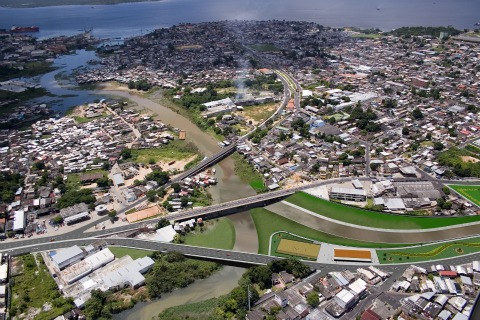
Photo: Image courtesy of Figueiredo Ferraz. Photo by Warrington Redmel
This post was originally published on Smartplanet.com