South Korea to build 3D grid map for drone test flight

South Korea's Ministry of Land, Infrastructure and Transport has announced that it will start building a 3D map for use in designated areas by drone testers that will be finished within 2016.
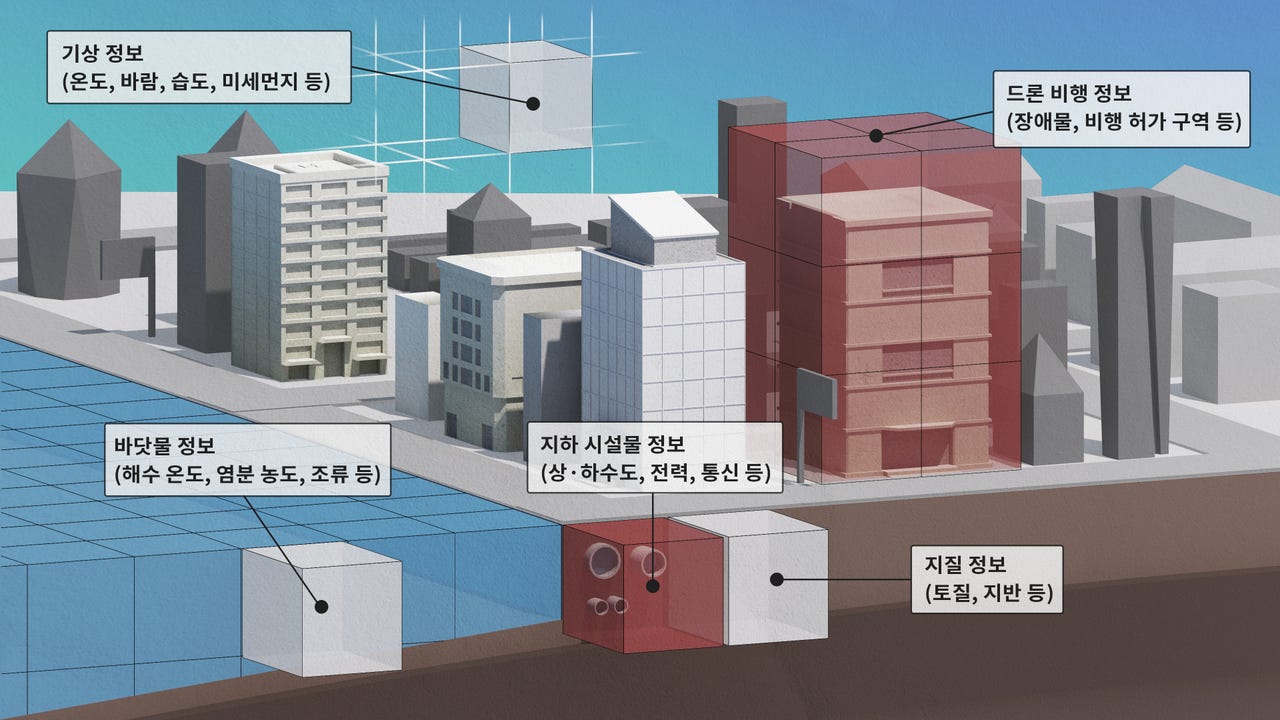
The 3D map will include precise information on space including obstacles, overcoming the limitation of 2D maps.
Latitudes of topographies, humidity, temperature, and existences of power lines and cables will be included in the maps, the ministry said. Research and development to adapt a 3D grid system will be done concomitantly.
Currently, certain air spaces in cities of Busan, Daegu, Jeonju, Yeongwol, and Goheung have been permitted for drone testing by operators approved by the government. The 3D map will be first built for Jeonju and Yeongwol.
Civilian use will only be considered after the map is completed and tested, the ministry said.
South Korea only allow very small drones in limited use for civilians.