How AI is saving homes and lives in California during wildfire season

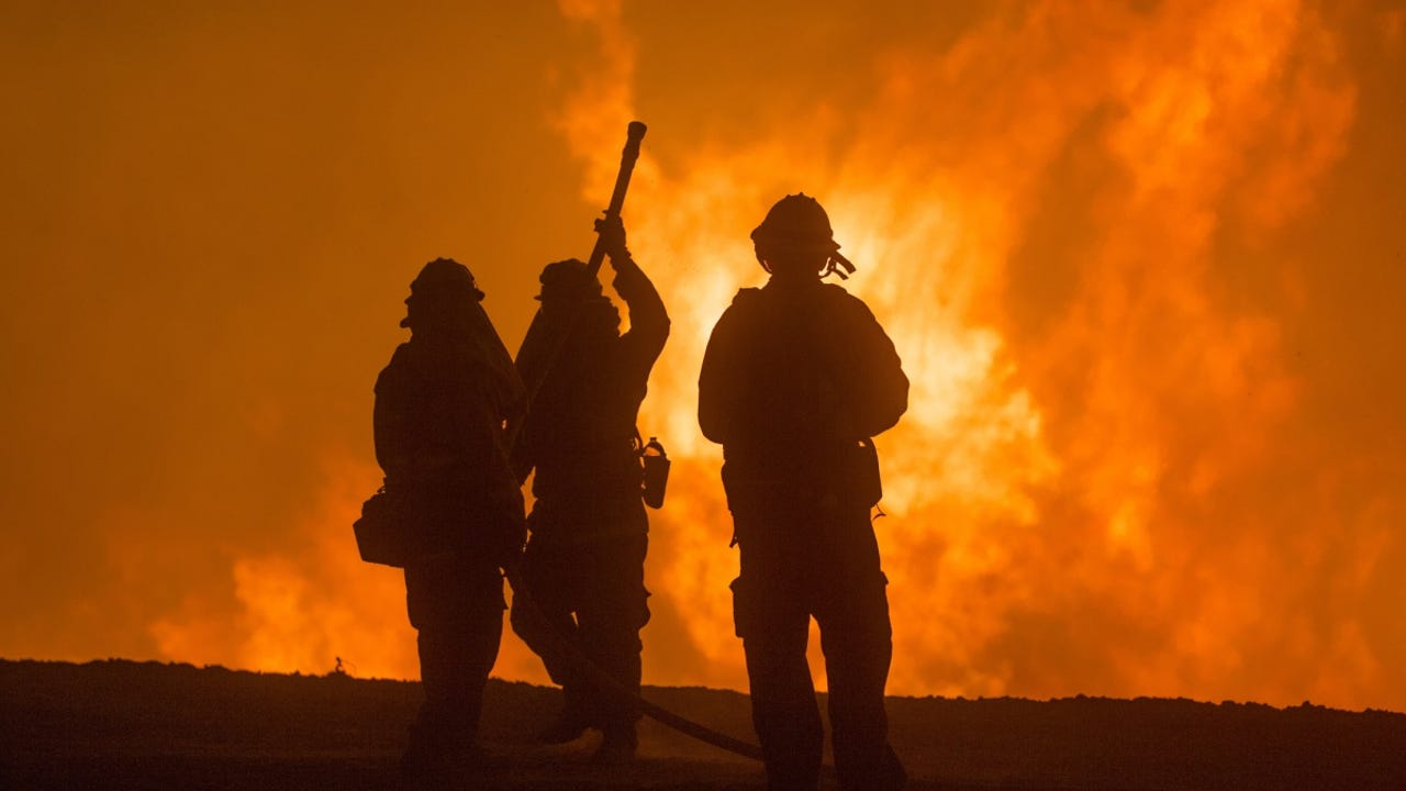
California wildfires have taken a huge toll on property and lives
If you're a Californian, you're probably at least a little anxious about losing your home and maybe even your life during the upcoming wildfire season. You're no stranger to the fact that over the past five years, from April to October, large blazes have devoured public land and private property causing hundreds of billions of dollars in damages and a tragic loss of life.
Also: How does ChatGPT work?
In 2017 alone, fires damaged or destroyed close to 11,000 structures, burning over 318,000 acres of land. In 2018, the Camp fire in Paradise, the most destructive in the state's history, destroyed 19,531 structures and killed 85 people. In subsequent years, fires have torched upwards of 10 million acres of land. Historically speaking, the state hasn't been a stranger to fires but when the top five fires in history have all taken place since 2018, you realize that something is going terribly wrong.
What's fanning the flames?
Those who study fire unanimously agree that perhaps the biggest catalyst for these fires was European colonization. Prior to this event, Indigenous residents practiced a sophisticated custom of planned burns that regularly eliminated hazardous forest and scrub undergrowth that would have acted as explosive fuel during the dry seasons. Consequently, over a hundred years of scrub undergrowth lies concealed as supercharged fuel. "Fire has always been an essential, inevitable system of California," says Michael Wara, Director of the Climate and Energy Policy Program at Stanford. "We seem to have forgotten how to manage it until now."
Also: Which fire extinguisher do you need? How to choose
The other catalyst is climate change. As we continue to rely on fossil fuels and cut down forests for animal rearing and agriculture, the earth's temperature is rising, leading to more disastrous, unpredictable weather events such as floods, heatwaves and fires at epic scales. In California, extreme heat and drought conditions now occur at regular intervals, drying out grassland, pine needles and other foliage, adding to the century-old tinderbox that stokes these enormous fires.
However, the state is now harnessing a powerful tool to dampen the effects of these fires, namely artificial intelligence, and specifically machine learning. The abundance of satellite imagery and geo-spatial data makes deep learning a worthy adversary to a mighty foe that is unpredictable and swift.
Also: This tiny keychain is a mighty tool for your personal safety
It is still early days in AI's fight against fire, but the ability to churn through billions of images both historical and current and pick out telltale patterns that point to potential hotspots gives Californians a potent new weapon against this force of nature. From detection, to predictive analysis to preventive action to evacuation procedures, here are some ways that AI is being used in that fight.
California's wildfire-fighting nerve center
If there was a NASA of wildfire response, University of California, San Diego would be it. The California state-funded university is home to a complex network of bodies that dovetail into each other for the purpose of tracking and predicting fire outbreaks.
WIFIRE offers a real time AI tool to frontline firefighters
Its eyes and ears are ALERTCalifornia, a public network of more than 1,000 high-definition, pan-tilt-zoom cameras positioned across the state and able to see up to 120 miles on a clear day. All of the live-feed data from these cameras is piped into its marquis programs -- WIFIRE -- located at USCD's Supercomputer Center, a war-room with walls made up of gigantic screens where real-time modelling and predictive analysis take place. (Here, for instance, a camera that spots what it thinks is smoke will alert UCSD whose algorithms will quickly determine, through comparison, whether it is in fact smoke, fog or a low-hanging cloud.)
Also: Fighting climate change: These 5 technologies are our best weapons
WIFIRE is part of FIRIS (Fire Integrated Real-Time Intelligence System), a public-private partnership in California that also uses aerial infra-red platform to provide real-time information from an active wildfire to USCD's nerve center. There, machine learning tools are used to crunch all that camera information including dynamic changes in wind, moisture, terrain and other factors using its AI algorithm. It then sends back a prescriptive analysis within five minutes to frontline teams staffed by Cal Fire and the California Office of Emergency Services as well as to a publicly accessible website called Firemap.
Wifire's dynamic map indicating the status of current wildfires and weather patterns in real-time
UCSD also hosts an umbrella network called WIFIRE Commons across universities, disciplines and industries that meshes AI, wildfire scientific disciplines, practice experts, industry, cyberinfrastructure and public agencies to foment continuous exchange and analysis of wildfire data. More than a thousand fires in 2022 were reportedly arrested by this network.
Fighting fire with fire
BurnPro 3d
Setting smaller fires to avoid the bigger, more devastating ones
Scientists and state officials have quickly come to understand that California's devastations can only be mitigated by a controlled burning of the hundreds of years of buildup of what is essentially prime fuel to control the behaviors of future wildfires. In other words, burn small fires so you don't have gigantic ones much like indigenous people in the region did for centuries.
Also: The best AI chatbots: ChatGPT and other interesting alternatives to try
Yet, burning vegetation blindly without any knowledge of the complex interplay between various factors such as dryness and weather could be catatstrophic. With support from the National Science Foundation, the BurnPro 3D team at UCSD uses AI techniques to provide land owners and state units in charge of fire mitigation burns a more sophisticated lens to understand the fire environment including detailed analysis of key factors such as winds and vegetation. Here's a demo of how it works.
Private players to the rescue
Zonehaven
Zonehaven's Evacuation Management System
Fighting California's humongous blazes stretches everybody thin so often regions or counties will bolster common resources with some AI software support from private players. Zonehaven is one such AI-based system that assists emergency responders to evacuate communities at risk by using machine learning to digest various feeds that include satellite pictures and weather predictions to figure out where and when fires could break out.
Zonehaven has partnerships with individual fire and police departments in at least a dozen counties in the state and puts out detailed and staged evacuation recommendations to avoid stampedes, and its resultant traffic jams. Individuals can log onto a detailed map containing roads, structures and vegetation along with simulations of how and where the fire will spread.
Alchera
Sonoma county, home to some of the country's most storied vineyards has been plagued by wildfires -- including the most devastating in the state's history at the time. The Tubbs fire that destroyed over 5,636 homes and killed 24 people was fanned by extreme wind storms that shifted directions unexpectedly and at whim.
Also: Generative AI could lower drug prices. Here's how
Consequently, Sonoma county recently contracted SaaS AI outfit Alchera, a South Korean company out of Seoul to come up a fire detection solution based on its proprietary machine learning system while piggybacking on the state's Alert cameras. The company is using millions of images from these cameras over time to train its algorithm to detect what constitutes smoke and what doesn't. In an ironic twist, the South Korean Minister of Interior and Safety recently visited Sonoma to see if Alchera can play a role in dousing recently rampaging wildfires back home in Korea.
Spotting the tinderboxes
Stanford University's Krishna Rao completed what may just be one of the most timely PhDs in California's history recently in which he developed a deep learning algorithm that evaluates how wet or dry the state's vegetation is. Figuring out which dry scrubland is a waiting fuel bomb and which areas are not a threat will be crucial information to a resource and personnel-strapped state conducting necessary controlled burns.
As Rao explains it, "A satellite radar bursts microwaves at an area of forest. If the trees are dry, nothing happens; the microwaves just pass through. If the trees are wet, they reflect the microwaves back to the satellite indicating a low-risk of fire."
Insuring homeowners more accurately
Perhaps the biggest, overwhelming worry plaguing Californians today apart from fearing for the loss of their lives and homes is if they will get dropped by their home insurance company.
US Forest Service's Law Enforcement division rescuing beleagured homeowners
Hundreds of thousands of homeowners have been dropped every year recently and forced to migrate to the state's California FAIR Plan -- a state-run pool that provides coverage of last resort. This is because the old model of insurance that is still plied today functioned in a reliable world, where climatically very little changed. These models ran 10,000 simulations to churn their numbers which, in today's climate changing world is beyond anemic.
Also: 6 best ways to make your gadget use greener (and save money, too)
Kettle.ai, a reinsurance company -- that provides insurance to insurers so they don't go bankrupt -- is trying to fix that by using an AI model that provides a far more realistic computation of the risks involved. Using over 2 million computations that include real-time, satellite-fed data, Kettle discovered that 25% of California was being penalized for wildfire issues in just 0.1% of the country.
"Some places are 10 times more dangerous. And some places are only 10% more dangerous. But if you just increased everyone by 3x, that doesn't fix anything," says Kettle's co-founder and COO Nathaniel Manning. As a result, their insurance company clients who get to see this data drop a lot fewer homeowners and implement a far more realistic pricing policy for them.
Zesty.ai is another insurance player using AI to assisit those dropped by insurance due to wildfire risk. The state of California has officially selected the AI company's Z-Fire product, which evaluates wildlife risk at the individual property level, to help all those in the FAIR plan pool who are struggling to get insurance. This includes recommending building hardening methods that can help them qualify for coverage.
Also: What is generative AI and why is it so popular? Here's what you need to know
Stanford's Michael Wara, who also designed and oversees the FAIR plan, says that AI-based insurance outfits have provided relief for thousands. "But unless there is translation into public policy and risk reduction -- like helping harden homes against fire -- you won't be able to make meaningful headway in preventing major loss events like the fires of the last five years."