Images: Satellite images give striking storm views

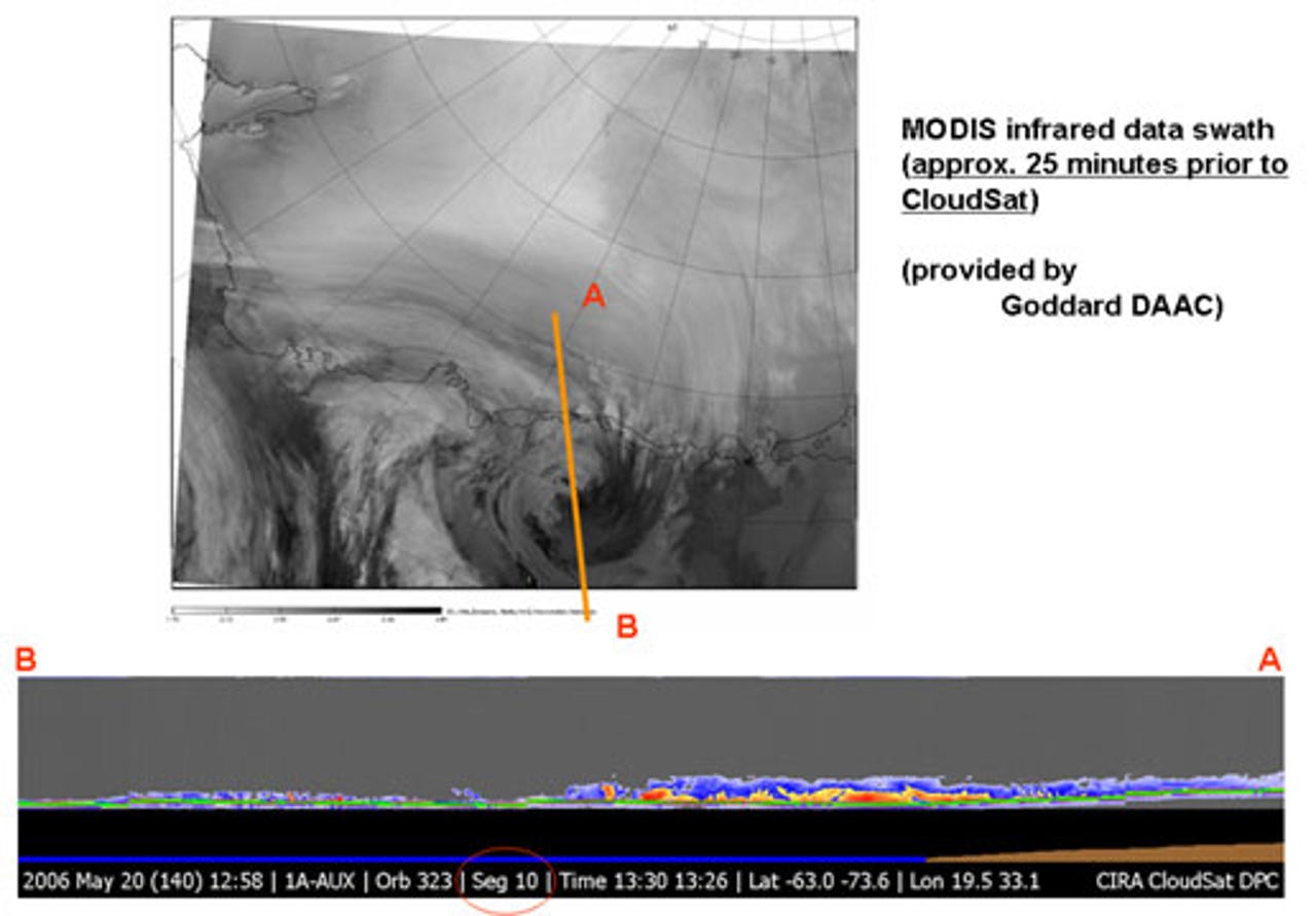
Antarctica
"CloudSat's radar performed flawlessly, and although the data are still very preliminary, it provided breathtaking new views of the weather on our planet," Graeme Stephens, CloudSat principal investigator and a professor at CSU Fort Collins, said in a statement. "All major cloud system types were observed, and the radar demonstrated its ability to penetrate through almost all but the heaviest rainfall."
This is a CloudSat image of a polar night storm near Antarctica. The top image shows the area being observed. The bottom image is a horizontal cross-section of clouds. The red spots represent rain or ice crystals, blue are thin clouds, and green is the horizon.
Eastern Africa
This CloudSat image shows a cross-section of tropical clouds and thunderstorms over eastern Africa. The layered view of storms like these give scientists a better idea of what is happening inside them. CloudSat's Cloud-Profiling Radar is more than 1,000 times more sensitive than typical weather radar and can distinguish between cloud particles and precipitation.
Norwegian Sea
This CloudSat image shows a warm front storm over the Norwegian Sea. Images of the North Sea were the very first taken by the radar-activated satellite.