Photos: Exploring virtual shipwrecks

Check out Europe's maritime relics without getting wet
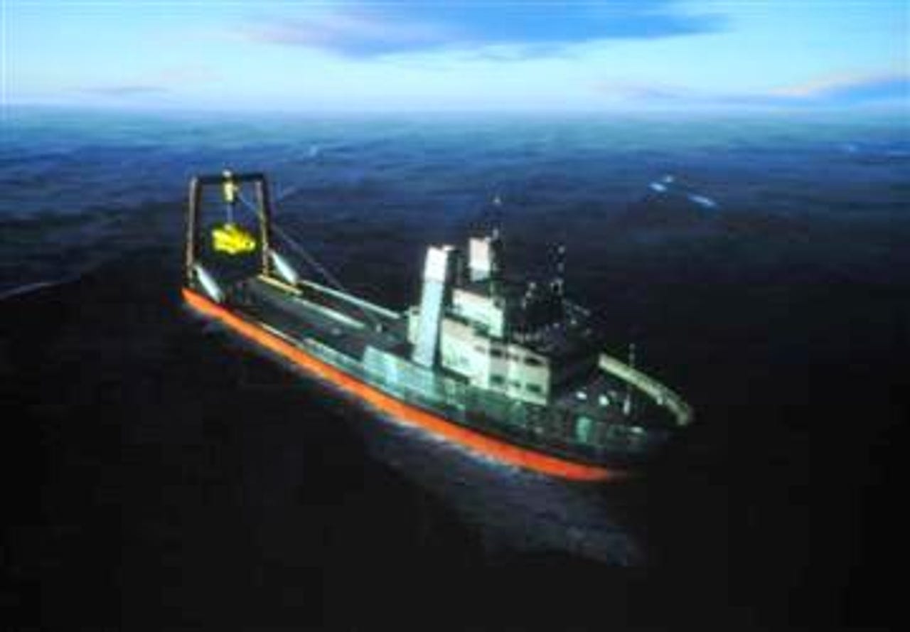
Ever wanted to explore Europe's shipwrecks without donning your wetsuit? The Virtual Exploration of Underwater Sites (Venus) project is already working on it.
Organisations specialising in archaeology, underwater exploration, virtual reality and digital data preservation, including the University of Hull, are working on the project to map out the shipwrecks around Europe's coastline.
Just a handful of wrecks around France, Italy and Portugal have been mapped so far but the project is already producing images such as the one above that shows the vessel from which users will be able to start their virtual shipwreck tour.
Picture credit: University of Hull
Want more great photos?
♦ Photos: A first glimpse of the ID card
♦ Photos: How computing cracks terrorist networks
♦ Photos: The best of Google Earth
In order to create the images, the Venus project uses this remotely operated submarine that maps out each shipwreck and the surrounding sea bed.
This data is then used to create the virtual environments and shipwrecks which people will eventually be able to explore online.
Picture credit: Venus project
Want more great photos?
♦ Photos: A first glimpse of the ID card
♦ Photos: How computing cracks terrorist networks
♦ Photos: The best of Google Earth
The University of Hull recently showed how a virtual shipwreck tour might look at the BA Festival of Science in Liverpool with the help of a 3D simulator.
The simulator lets the viewer control a virtual submarine that takes them around the shipwrecks. This shows a figure representing the viewer waiting to get into the submarine.
Picture credit: University of Hull
Want more great photos?
♦ Photos: A first glimpse of the ID card
♦ Photos: How computing cracks terrorist networks
♦ Photos: The best of Google Earth
The aim of the Venus project is to digitally recreate Europe's shipwrecks before they become eroded and therefore impossible to explore for real.
This is the virtual submarine in the water. The figure representing the viewer is shown controlling the submarine with a remote handset.
Picture credit: University of Hull
Want more great photos?
♦ Photos: A first glimpse of the ID card
♦ Photos: How computing cracks terrorist networks
♦ Photos: The best of Google Earth
Here's the view from the submarine with a shipwreck looming beyond the search lights.
As the project progresses archaeologists and interested members of the public will be able to explore many more shipwrecks in this way.
Picture credit: University of Hull
Want more great photos?
♦ Photos: A first glimpse of the ID card
♦ Photos: How computing cracks terrorist networks
♦ Photos: The best of Google Earth