Japan launches rocket for homegrown GPS

Japan is building its own GPS in the hopes of reducing location errors for drivers, drone operators, and other users.
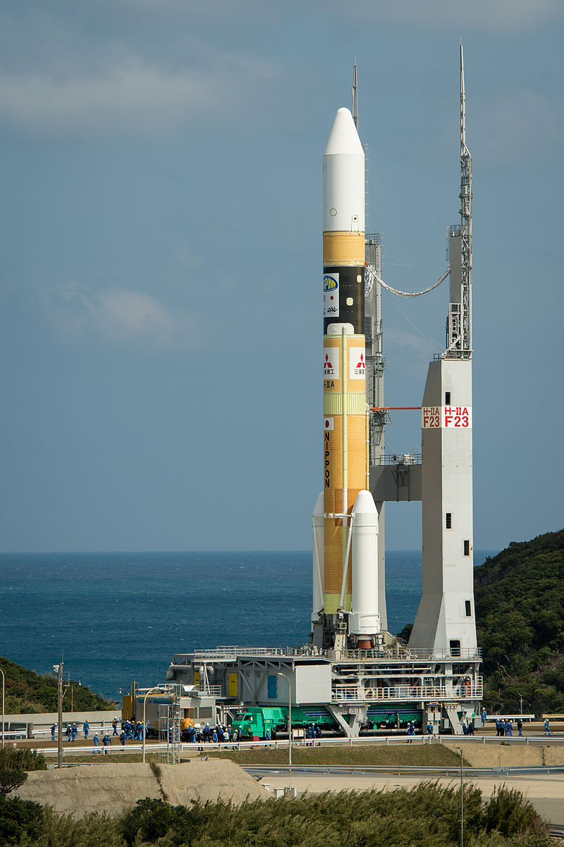
The Japan Aerospace Exploration Agency (JAXA) and Mitsubishi Heavy Industries on Thursday launched a H-IIA Launch Vehicle from the Tanegashima Space Center, located on an island south of Kyushu, carrying a satellite that will form part of a Japanese GPS.
An initial satellite was launched in 2010, and JAXA plans to launch two more satellites by next year to complete the Michibiki system. Michibiki is the Japanese word for guidance.
Latest news on Asia
Japan currently relies on the United States' Global Positioning System. Having its own system is expected to reduce location errors in Japan from as much as 10 metres to a few centimetres, by some estimates.
Three satellites will be visible at all times from the Asia-Pacific region, and the Japanese system could be integrated with the American one, enabling highly precise positioning, the Japanese government said.
Japan is considering adding three more satellites to the system in the future, as mountains and tall buildings will still affect the positioning under the four-satellite system.
The more accurate positioning information could be used for both driving and drone deliveries. Japanese media has reported that it may also enhance the country's defence capabilities.
Autonomous vehicles rely on correct and accurate positioning, but thanks to continental drift, the Earth is far from stationary. In the case of Australia, it is closing in on being two metres out of place compared to where maps state it is.
"When GDA94 [Geocentric Datum of Australia] was adopted in 2000, GPS locations were 'accurate' to 100 metres," the Australian Intergovernmental Committee on Surveying and Mapping website states.
"Since then, however, two important things have happened: Australia has moved about 1.5 metres northeast, effectively moving the location of mapped features and their associated GDA94 coordinates. At the same time, positioning technology has evolved considerably."
The Australian government is spending AU$12 million over three years to trial a satellite-based augmentation system within the country that is looking to increase accuracy to several decimetres and down to 5 centimetres for Precise Point Positioning, Geoscience Australia said earlier this year.
Europe's GPS alternative, Galileo, began offering early functionality in December last year, but it was open to spoofing attacks. A team of researchers from Belgium arrived at a way to apply a TESLA signature to the civilian satellites within the Galileo constellation.
Galileo will not deploy TESLA signatures to the public until 2018, with the 24-satellite constellation set to be fully operational in 2020.
With AAP