Mining 2030: find virtual gold

CSIRO has launched a new research department "Minerals Down Under" to keep the Australian resources industry and its employees at the cutting edge up to 2030.
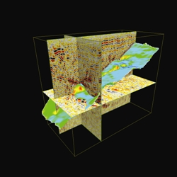
A 3D model (Credit:CSIRO)
In 12 years, the department aims to have every explorer using 3D modelling, which will be combined with new geophysical techniques to gather information on sub-surface rocks. The new tech will make searching for minerals easier, especially in environments where a bore cannot be sunk every 500 metres to collect data.
In CSIRO's 2030 plan, Australian geologists will be the "best trained mineral explorers on earth, with the ability to develop 3D geological interpretations and simulate all geological processes within them without the need to call on expert consultancies for assistance".
David Gray, the unit's exploration theme leader, says the 2030 vision is close to being achieved already: "If you look at Australian geologists now, you wouldn't be far off the mark to say that," he told ZDNet.com.au.
However, geologists won't need to become geeks to take advantage of the new technology. "We're not trying to turn every geologist into a computer nerd. We're trying to create tools for the geologist to use," he added.
According to Gray, the industry is already using tools which take some forms of data and make a model, but what it can't do now is put many different sources of information, including that from new geophysical methods, together to get a good model very quickly.
"All the sort of data we're talking about, be it geological maps or other, sits all over Australia," Gray said, dispersed over many different organisations. CSIRO wants to make it as easy as possible for explorers to get data from any number of these diverse geological surveys, allowing them to access a 3D map of a rock structure and understand better where they want to drill.
Trying to integrate this data is difficult, he said, saying it requires creating a common data language for all geological surveys.
Another aim for 2030 is to have 1:100,000 geological 3D interpretations of the whole continent, a scheme that would involve terabytes and terabytes of data.
Making models from reams of data requires a lot of computing power, Gray said, which can't be done on a laptop. The tools will need to be internet-based, so the explorers can send information from the mining site to a supercomputer network where it will be modelled. "All the hard grunt would be sucked from the desktop and computed somewhere else," he said.
In some cases it might be sent back to a 3D room in the explorer's base, where they could put on 3D goggles and walk into the mineral structure, Gray said.