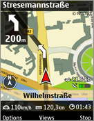
MWC08: Nokia announces Maps 2.0 with pedestrian-focused features


The pedestrian navigation component, called Walk, include a bread crumbs trail that can be used to mark virtually where you have been so you may use this trail to go back the same route. Nokia Maps 2.0 also includes hybrid satellite maps to give you a better sense of landmarks and orientation in a place you may not be familiar with. You get information on surrounding buildings, streets, and even pathways too. Nokia includes data for mass transit rail systems in 17 cities around thhe world so you can actually figure out where you need to go to get on and off the system.
Like the first version of Nokia Maps you can purchase multimedia guides and premium navigation services on different subscription levels. I get by fine in most case with Google Maps so I plan to give the free version of Nokia Maps with this new pedestrian component a try soon.
Another aspect of the Nokia 2.0 announcement that is compelling for many people is the fact that they will be supporting Series 40 devices, which account for more users than with S60.
This new version will ship on the new handsets announced this week, but current S60 owners can visit the Nokia Beta Labs site and get it now.