Images: Rita prepares to wreak havoc

Rita
In addition to the winds, 8 to 12 inches of rain are expected along the storm's path, with 3 to 5 inches of rain predicted for New Orleans. Accumulations could reach 25 inches in some areas. Coastal flooding of 15 to 20 feet above tide level is expected along with dangerous battering waves where the center makes landfall.
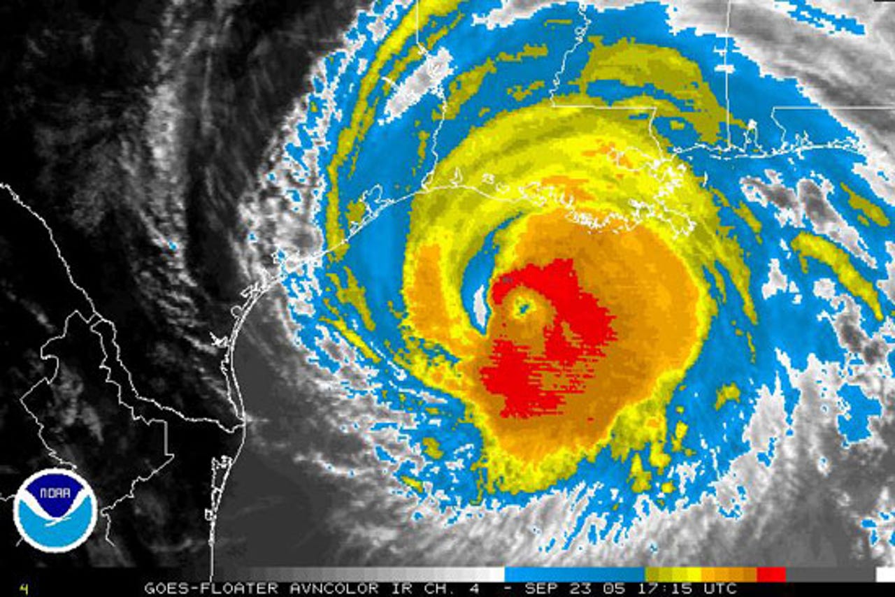
This satellite image from 1 p.m. CST on Sept. 23 shows the storm is already over much of Louisiana. Hurricane-force winds extend about 85 miles from the center.
path
Here is the storm's predicted route--the eye is expected to hit land on Saturday near the Louisiana-Texas border, Sept. 24.
heat tower
This 3-D image of Hurricane Rita's clouds was produced Sept. 19 by NASA's Tropical Rainfall Measuring Mission (TRMM) satellite. The two giant chimney clouds extend more than 11 miles high.
water temperature
Weather forecasters fear that this storm could attack the Gulf Coast with the fury of Katrina. Hurricanes generally get stronger when the water temperature is above 82 degrees Fahrenheit. This map shows water temperature of the Gulf of Mexico on Sept. 18. Orange and red indicate water temperature above 82 degrees Fahrenheit.
Loop Current
Hurricane Katrina gained strength dramatically when it reached the Loop Current, which is a large ring of warmer water. The dots show the path and intensity of the storm, red marking the most intense spots.
New Orleans
Although the eye of Rita is predicted to stay southwest of New Orleans, a slight change of course could significantly add to the city's devastation. This photo of New Orleans was taken shortly after Katrina swamped the city.