Images: Satellites watch wildfires burn

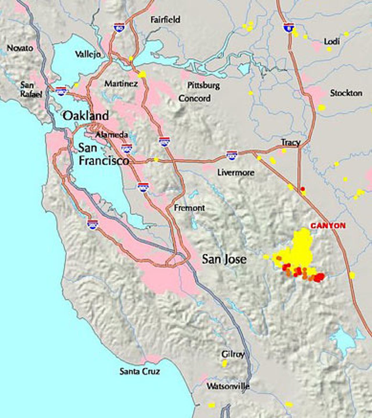
Bay Area image
MODIS (Moderate Resolution Imaging Spectroradiometer) imaging devices mounted on two NASA satellites monitor the earth and can pinpoint a fire within a 500-meter distance.
The instruments return data that is then turned into maps such as this one, which shows the location of past and actively burning fires near the San Francisco Bay Area. On July 9, a wildfire broke out in Stanislaus County, Calif., east of San Jose, damaging parts of Henry Coe State Park.
Yellow on the map indicates an area that has burned at some point since Jan. 1; orange shows an actively burning area (in the last 24 hours); red shows an actively burning area (in the last 12 hours).
NASA, the U.S. Forest Service, the University of Maryland and the National Interagency Fire Center all participate in the program.
Day-by-day comparison
At 7 p.m. on July 9, there is only a small yellow spot, indicating that a fire had burned in the area at some point during the calendar year. By 3 a.m. the next morning, however, several red spots appear, indicating active fires. The fires continue to grow over the next few days, peaking on July 12. The last image shown here, taken by the MODIS instruments at 7 a.m. on July 17, shows how extensive the burn area was.
An update on the Forest Service's Web site the evening of July 17 indicated the fire was approximately 85 percent contained but had scorched nearly 33,000 acres of land.
Several government sites make it possible to get frequently updated information on active wildfires. The National Interagency Fire Center has updated news and information regarding the status of active wildfires, as well as statistics on past fires and suppression costs.
NASA satellite
Steve Chien, of NASA's Jet Propulsion Laboratory, explains how the networked satellites work in this short video.