Incredible photos of Earth from space (photos)

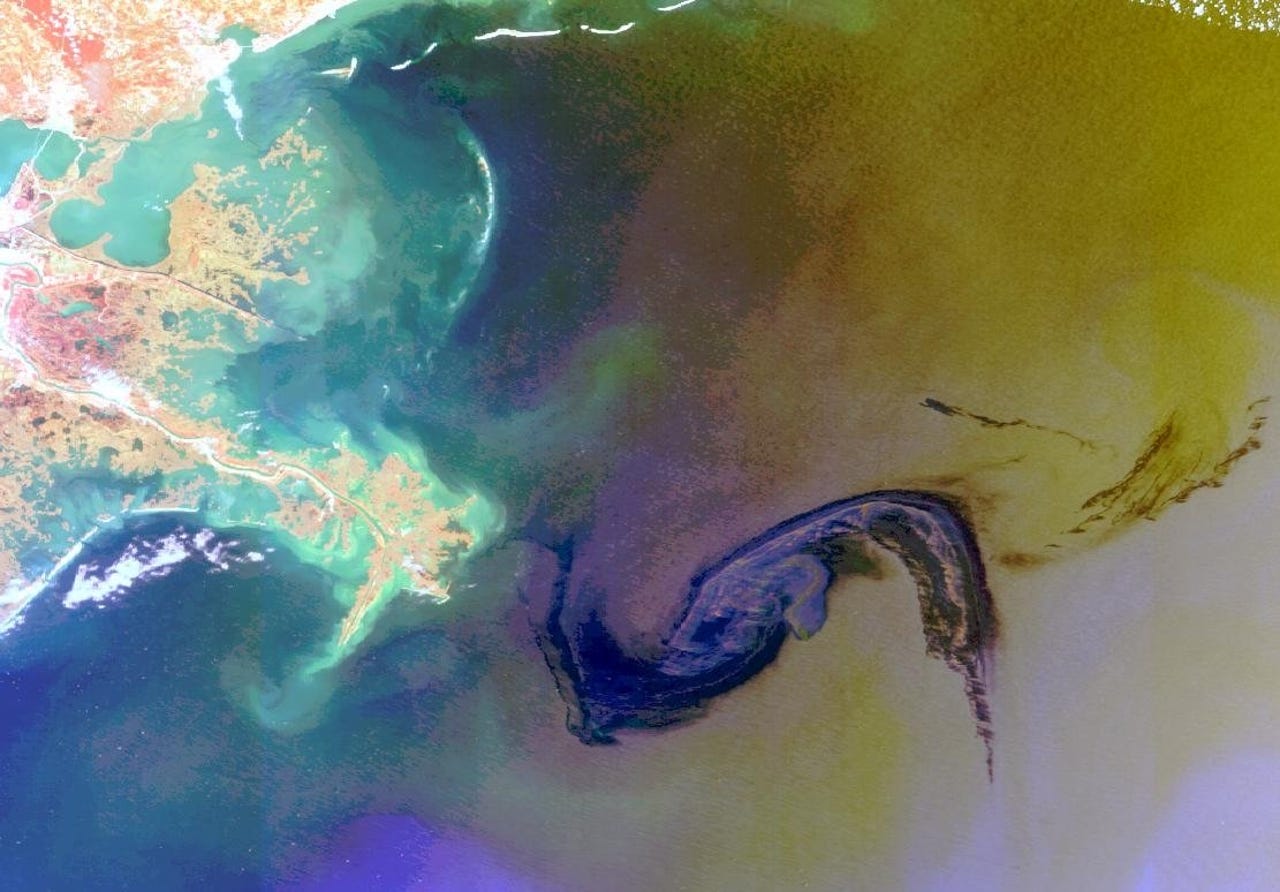
The 2010 Gulf of Mexico oil spill from space. (ESA)
This post was originally published on Smartplanet.com"Snowmaggedon" in January 2011 left thousands without electricity, snarled road traffic, closed schools and stranded travelers whose flights were cancelled. Boston and Cape Cod are visible in the upper right, and New York City below them. On the left, under the snow, are three of the five Great Lakes - Lakes Huron, Ontario and Erie. (ESA)
This post was originally published on Smartplanet.comMilan at night, January 2011. (ESA/NASA)
This post was originally published on Smartplanet.comThe Lake Eyre Basin in central Australia is about the size of France, Germany and Italy combined. (ESA)
This post was originally published on Smartplanet.comThe Imperial Valley in Southern California has 3,100 miles of irrigation canals and 494,000 acres of agricultural land. Its leading crops include vegetables, wheat, alfalfa and livestock. (Japan Aerospace Exploration Agency, ESA)
This post was originally published on Smartplanet.comThe snow-sprinkled Himalayan Mountains between the peaks of the Tibetan Plateau (top) in Central Asia and the plains of Nepal, Bhutan and India in the Indian subcontinent. This false-color image shows lush, green vegetation as bright red. (ESA)
This post was originally published on Smartplanet.comA gecko-shaped body of water formed by the Bratsk Reservoir in southeastern Siberia. The reservoir was created in the 1960s when the Angara River was dammed to provide hydroelectric power. (ESA)
This post was originally published on Smartplanet.comThe shallow blue waters around the Bahamas and their surrounding coral reefs as seen from 500 miles out in space. At top left is the southern tip of Florida and at the bottom is Cuba. Between them is the Cay Sal bank, appearing as a small area of light blue water. (ESA)
This post was originally published on Smartplanet.comThe Gedo region in southwest Somalia, 250 miles west of Mogadishu and 500 miles north of Nairobi. (JAXA, ESA)
This post was originally published on Smartplanet.comRussia’s Volga Delta and the Caspian Sea. This image was created by combining three radar shots five weeks apart. The colors result from changes in the surface that occurred during the intervals. (ESA)
This post was originally published on Smartplanet.comA composite radar image of Tanezrouft Basin in the Algerian Sahara -- a landscape of hills, basins, steep canyon walls, stone plateaus and multi-story sand dunes. Wind erosion formed the concentric loop patterns in the sedimentary rock, and very low cliffs and faults appear bright. (ESA)
This post was originally published on Smartplanet.comThese clockwise and counterclockwise ‘Von Karman vortices’ south of the Canary Islands off the northwest coast of Africa were created as wind blowing from the north over the Atlantic was disturbed by the archipelago. (ESA)
This post was originally published on Smartplanet.comOne of the ever-shifting Aurora Australis displays visible near the South Pole. These colored ribbons, curtains, rays and spots are created when charged particles from the sun interact with Earth's magnetic field. (NASA)
This post was originally published on Smartplanet.com