X

Photos: Learning from disaster

Visitors are educated about how scientists study and measure quakes at the U.S. Geological Survey Visitors Center.
By Bill Detwiler, Contributor
12812.jpg
1 of 11 Bill Detwiler/ZDNET

Visitors Center

Visitors are educated about earthquake technology and how scientists measure and predict quakes at the Visitors Center at the U.S. Geological Survey in Menlo Park, Calif.

12813.jpg
2 of 11 Bill Detwiler/ZDNET

San Andreas Fault

Pictures of the San Andreas Fault grace the walls of the entrance to the Robert E. Wallace Earthquake Center at the U.S. Geological Survey in Menlo Park, Calif.

12814.jpg
3 of 11 Bill Detwiler/ZDNET

Brad Aagaard

Geophysicist Brad Aagaard of the U.S. Geological Survey creates computer animations to map the strength of earthquakes in California.

12815.jpg
4 of 11 Bill Detwiler/ZDNET

Sacramento Delta

A computer-animated mapping details shaking intensity in the Sacramento Delta.

12816.jpg
5 of 11 Bill Detwiler/ZDNET

Seisometer

Instruments like the seisometer help scientists determine the strength of an earthquake.

12817.jpg
6 of 11 Bill Detwiler/ZDNET

Slickensides

A plaster cast of "slickensides," parallel striations on rock surfaces produced by relative motion across opposite sides of fault planes, along the Hayward Fault at the U.S. Geological Survey Map Center in Menlo Park, Calif.

12818.jpg
7 of 11 Bill Detwiler/ZDNET

Mitch Adelson

Cartographer Mitch Adelson of the U.S. Geological Survey in Menlo Park, Calif., sells topographic maps such as this to visitors from all parts of the country.

12819.jpg
8 of 11 Bill Detwiler/ZDNET

U.S. Geological Survey

The U.S. Geological Survey in Menlo Park, Calif., houses rows and rows of maps of fault lines in the U.S.

12820.jpg
9 of 11 Bill Detwiler/ZDNET

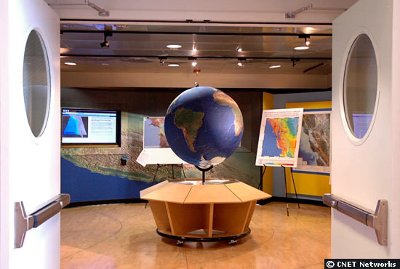
Globe

Slips in the earth cause stress to fault lines, ultimately resulting in an earthquake. Scientists at the U.S. Geological Survey use globes such as the one shown here to study the inner surfaces of the earth and how slips and stresses may occur.

12821.jpg
10 of 11 Bill Detwiler/ZDNET

Visitor Center

The Visitor Center at the U.S. Geological Survey in Menlo Park, Calif., catalogs earthquake surveys from past decades.

12822.jpg
11 of 11 Bill Detwiler/ZDNET

Poster

This poster is just one of the many that blanket the walls of the U.S. Geological Survey in Menlo Park, Calif., commemorating the San Francisco earthquake of 1906.

Related Galleries

Holiday wallpaper for your phone: Christmas, Hanukkah, New Year's, and winter scenes
Holiday lights in Central Park background

Related Galleries

Holiday wallpaper for your phone: Christmas, Hanukkah, New Year's, and winter scenes

21 Photos
Winter backgrounds for your next virtual meeting
Wooden lodge in pine forest with heavy snow reflection on Lake O'hara at Yoho national park

Related Galleries

Winter backgrounds for your next virtual meeting

21 Photos
Holiday backgrounds for Zoom: Christmas cheer, New Year's Eve, Hanukkah and winter scenes
3D Rendering Christmas interior

Related Galleries

Holiday backgrounds for Zoom: Christmas cheer, New Year's Eve, Hanukkah and winter scenes

21 Photos
Hyundai Ioniq 5 and Kia EV6: Electric vehicle extravaganza
img-8825

Related Galleries

Hyundai Ioniq 5 and Kia EV6: Electric vehicle extravaganza

26 Photos
A weekend with Google's Chrome OS Flex
img-9792-2

Related Galleries

A weekend with Google's Chrome OS Flex

22 Photos
Cybersecurity flaws, customer experiences, smartphone losses, and more: ZDNet's research roundup
shutterstock-1024665187.jpg

Related Galleries

Cybersecurity flaws, customer experiences, smartphone losses, and more: ZDNet's research roundup

8 Photos
Inside a fake $20 '16TB external M.2 SSD'
Full of promises!

Related Galleries

Inside a fake $20 '16TB external M.2 SSD'

8 Photos